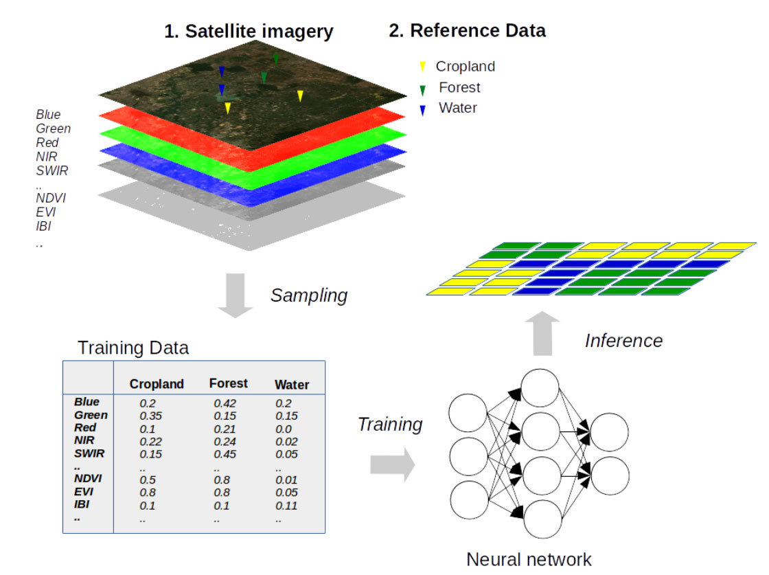
The main step in the crop mapping analysis is fitting the NN model. This part of the module covers the overarching workflow of model fitting and includes the programming code needed to follow the entire pipeline. Starting with taking a processed training dataset from the previous module, it includes setting model parameters, training, testing, and evaluating a model, creating inference (the step where we create a crop map), and inspecting the final results. At the end of this step, we will have a map of the target crop type based on the input training data and satellite data given.