In this online tutorial, we use Google Earth Engine and the Google Cloud Platform. Google Earth Engine is a cloud-based tool that lets users analyze large amounts of geospatial data quickly. It provides access to a huge archive of satellite images and other data, as well as computational tools to analyze it. You can use Google Earth Engine for free if you sign up for an account. This tutorial aims to introduce participants to the basics of Google Earth Engine and show them how to use it to classify and map crop types in Cambodia.
Here, beginners can learn some background on the Google Cloud environment which we will rely on for our data analysis. This includes:
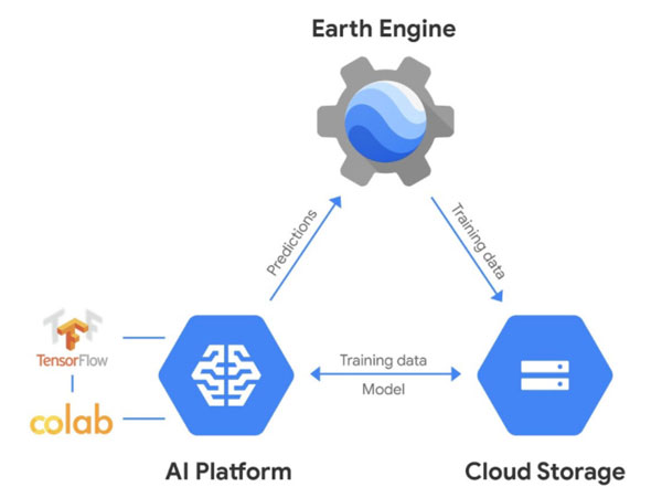
Figure: The Google Cloud Ecosystem

In this online tutorial, we use Google Earth Engine and the Google Cloud Platform. Google Earth Engine is a cloud-based tool that lets users analyze large amounts of geospatial data quickly. It provides access to a huge archive of satellite images and other data, as well as computational tools to analyze it. You can use Google Earth Engine for free if you sign up for an account. This tutorial aims to introduce participants to the basics of Google Earth Engine and show them how to use it to classify and map crop types in Cambodia.

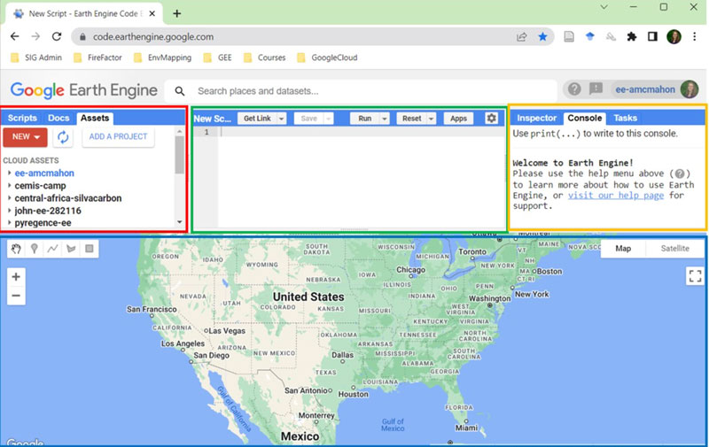
Google Earth Engine's browser-based JavaScript API
Here, you will be guided through your first steps in Google Earth Engine (GEE). In addition to using the GEE JavaScript API, GEE can also be used with a Python API. This option is more advanced and requires experience in Python programming, but it allows the user to access common machine learning libraries like TensorFlow, which we use to train Neural Network models. This module will show you how to use Colab notebooks, which are user-friendly ways of running Python scripts, and how to use Google Earth Engine with the Python API in a Google Colab notebook. You will also learn how to inspect and process satellite images using these tools.